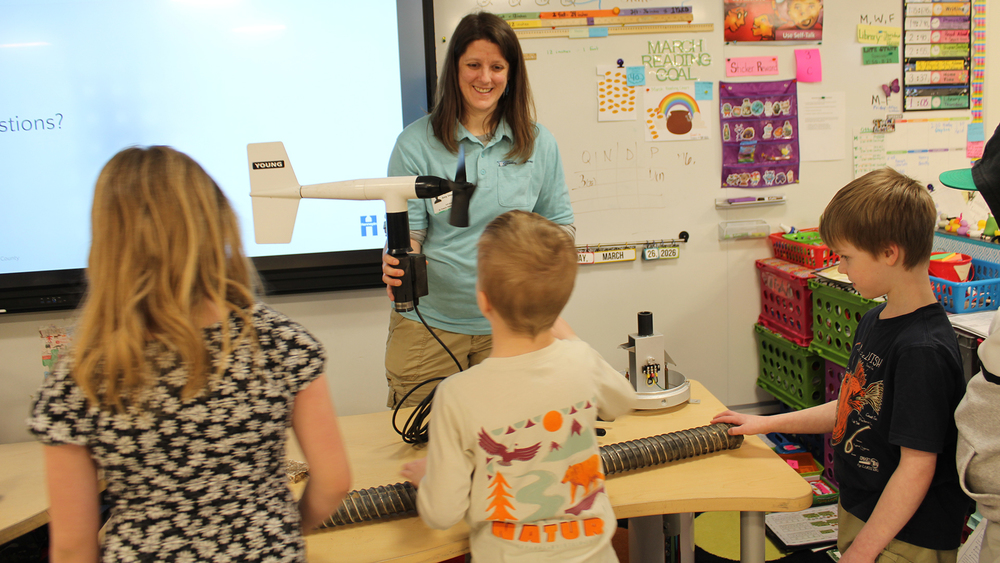
Amy Stephens, a Mesonet Systems Meteorologist with Hennepin County Emergency Management visited St. Francis Elementary School 3rd graders to talk about the tools she uses to prove near real-time weather data to make important public warning decisions.
Stephens met with two classes at a time and in addition to a presentation, brought some of the tools and equipment used by the stations to measure the weather. Students were able to ask questions throughout the presentation and get to touch the equipment. View photos from the visit.
“Since weather affects everyone, it gives students hands-on experience with a real-world tool that helps us understand how the weather impacts safety, agriculture, transportation, and their lives,” Stephens said. “It also encourages curiosity and awareness about the environment.”
The Hennepin West Mesonet System has 26 stations with a 30-foot tower and one station with a 10-foot tripod. These stations collect air temperature, relative humidity, wind speed, wind direction, solar radiation, rainfall, barometric pressure, black globe temperature, soil moisture, and soil temperature. A select handful of stations also collect lightning, freezing rain, present weather and visibility, and 2m wind speed.
“The favorite part of my visit was hearing all the awesome questions,” Stephens said. “It’s so fun talking about weather sensors and seeing light bulbs go on and hands shoot up excitedly.”
What is a mesonet?: A mesonet is a network of fixed, portable, or mobile land stations for automated, real-time monitoring at the mesoscale. Observations are typically collected at subhourly intervals from levels of 1m below ground to 10m above ground level from stations spaced tens of kilometers apart or less. Mesonets use professional station siting, equipment, and maintenance/calibration to ensure data are suitable for research and climatology.
What does a mesonet do?: The Hennepin West Mesonet was created to provide emergency managers and incident commanders with real-time environmental data to support their critical response decisions. Our station spacing ranges from 2.5 to 5 miles apart due to our dense population across Hennepin County. Our network has approximately 297 sensors across all stations.